


Early Views around Narberth Station
The Narberth Pennsylvania Railroad station was built in 1870 as "Elm Station", and renamed in 1892. These photographs of its surroundings in the 1890s, before and just after the 1895 incorporation of the borough, illustrate how sparse the town was in its first days.
The Old Gulph Road (subsequently named Narberth Avenue where it passes through the borough) had a grade crossing at Elm where the Narberth Avenue railroad bridge is today. The grade crossing necessitated the construction of the first of two signal towers that eventually stood side by side at Elm Station until the older one was removed. The purpose of the second tower was to regulate the use of a coal yard cutoff to the north, and it also served the slightly later freight-station cutoff south of the Main Line tracks.
— Victoria Donohoe, A Cultural History of Narberth, page 59 (unpublished as of 2026)
No contemporary maps show such a grade crossing. An 1877 contract for building “a wooden Overhead bridge across "Sullivan's Cut" Philadelphia Division P.R.R. in line of the new road East of Elm Station P.R.R.”, preserved at the Hagley Museum Archives, would seem to portend the birth of what would become South Narberth Avenue.

This bridge became a favorite platform for photography of the station. Hagley Museum and Library, c. 1905 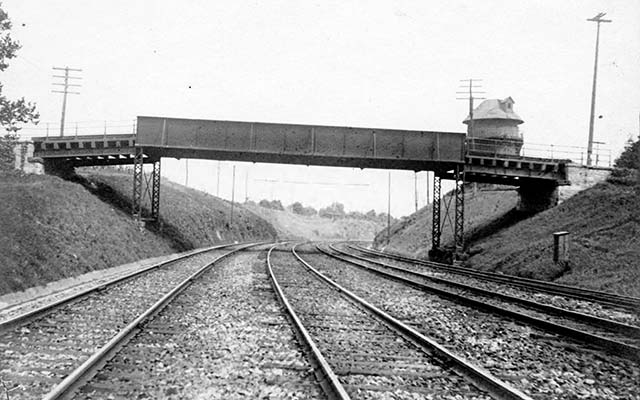

The siding to the left (south) of the tracks appears in property atlases from 1900 to 1926. An 1100-foot siding that was built in this location for the Grangers Centennial Encampment in 1876 is not shown in subsequent atlases of 1877, 1887 or 1896. The siding has disappeared by the aerial photograph of August 1929.

Updated July 9, 2026.