About the Narberth History Map
How to use the map
| ICON | |
|---|---|
Map Layers: to show/hide a layer. Move the slider towards the left to make a layer less opaque (more transparent), revealing the layer below it; useful for comparing two or more layers or a layer with the basemap. Click the i icon to see the title, author and publisher of the printed source of the layer. |
|
|
Location markers of Narberth places, grouped by themes, for example historical photograph locations, homes of Roll of Honor veterans. Click to open a popup with brief description and links to details. Historical photo markers indicate the age, location and heading of an historical image marked on the map, from the photographer's point of view. Darker indicates older, lighter more recent images. Stand there today, face towards the arrow head, and compare. |
|
Mark your current location, if your device has geolocation capabilities, and you give your permission. Tap/click the marker to open a popup where you can refresh your location or remove the marker; great resource for walks around town. The cross-hair marker shows the location your device reports; the circle around it is its reported accuracy. | |
The Narberth history movie! Click the play button to animate a succession of history layers in your current map view. You can set the play rate, and pause and re-start the action. As it plays, you can continue to pan and zoom the map. |
|
Find a Narberth address by selecting a Narberth street, then entering a street number to drop a marker at the address; helps you keep track of your chosen location while you fade the layers in and out. Our database includes some historical addresses that no longer exist (usually the building has been razed).
|
Historical photo markers indicate the age, location and heading of an historical image marked on the map, from the photographer's point of view. Darker indicates older, lighter more recent images. Stand there today, face towards the arrow head, and compare. |
Toggle the bottom layer (the basemap) between a map view and a satellite view. Default is map view. |
|
|
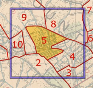
Check/uncheck the checkboxes to show/hide the map features. Narberth borough boundary: Showing this is helpful for orientation when inspecting the pre-1895 map layers. Extent of historical maps: This outline encompasses the area surrounding the borough that we plan to incorporate into every layer (see details below). Map tile outlines: Each layer is comprised of a grid of 256 × 256-pixel images that fit together seamlessly, thus the term "tiles". |
Historical map sources
The maps are from bound atlases of "Properties on the Main Line Pennsylvania Railroad From Overbrook to Paoli" published at four- to eight-year intervals. A. H. Mueller, who lived at 117 Forrest and was Narberth's first mayor, published four such editions from 1896 to 1920. His 1913 edition included a re-drawing of John Levering's 1851 map of Lower Merion which we use here, too.
All the maps from every edition (not just Narberth) are available in digital and physical formats:
Digital copies online
- Greater Philadelphia GeoHistory Network contains thousands of old maps, property atlases, city directories, industrial site surveys, aerial photographs and other items documenting the history and development of the city and its suburbs from the 1600s through today.
- Lower Merion Township is the source of the black and white map scans on the NHM.
Physical atlases
Constructing the map
We started in 2014 with high resolution scans downloaded from the Lower Merion Township website in black and white (the atlases were printed in color). Since then, we are grateful to have obtained color scans from two sources, the Villanova University Digital Library (1877, 1913) and the Radnor Historical Society (1881, 1887, 1893, 1896, 1900, 1908, 1926), as noted in the map source info that accompanies each layer. This will allow us to replace those black and white scans with full coverage color ones.
After we obtain scans, we prepare them for the map:
- Image cleanup to remove scratches and speckles, clean edges, make colors consistent, touch up and composite cleaner versions of hard-to-read sections. This is the most time-consuming part of the process. Software: Adobe Photoshop


Station circle, 1900 and retouching. "After" has 41% fewer bytes. - Align image with GPS coordinates.
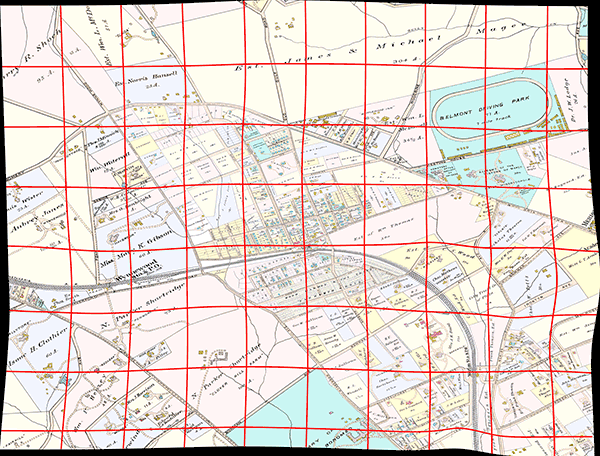
We mark the same set of locations on the map image and a modern map grid. Prime candidates include street intersections which have not changed over the decades, and buildings still standing today. By correlating common points, the image can be rotated, skewed, stretched and locally warped to fit the modern map, a process called georeferencing but more graphically described as "rubbersheeting". Software: QGIS


The 1900 map and georeferencing. - Slice the image into tiles. The map is comprised of 256×256 image tiles. Each zoom level requires its own set at appropriate enlargements. Software: MapTiler
- Tile image optimization to reduce file size for fast loading and consideration for your bandwidth and data limits. By using a two-step process, we have consistently been able to achieve 70% reductions in file size with no loss of quality. Software: Adobe Photoshop then FileOptimizer
The bottom layer, or basemap, is derived from OpenStreetMap, the Wikipedia of maps, which is to say that anybody can sign up for a free account and edit the map. Because we did just that, Narberth has building outlines and surrounding areas do not.
Whither the map?
History doesn't end at the borough border! So we want to start including Narberth's neighbors, just as you see on the pre-Narberth layers (before 1895). This means fitting together as many as seven pages from an atlas, not a trivial task given the different orientations and scales of each plate, and especially the unavoidable inconsistencies with the scanning process.

We want to show historic aerial and satellite photography on the map. In particular, the Delaware Valley Regional Planning Commission has made available aerial survey photographs at five year intervals starting 1959, and satellite imagery starting in 2000. There are other sources of photography dating back to the 1920s.
… and more layers, more photos, more markers! We think location is a great way to organize all sorts of information that pertains to an address, such as who lived there, when, what happened there, what it looked like, what's changed, what's stayed the same and more.
Technical requirements: Javascript must be enabled in your browser. Map functionality is tested in recent versions of Chrome, Firefox, Opera, Safari, mobile Safari, Edge and various Android browsers. Microsoft Internet Explorer is no longer supported.
Cookies: The map uses cookies to remember the layers, opacity, zoom and map center you (or rather your computer or device) were viewing on your previous session in order to recreate them next time. The cookies are updated with every such change you make, but expire after 90 days if not refreshed. The map and satellite base layers, which are provided by third parties, may leave their own cookies. If you disable cookies, the map and website will still work.

 Click anywhere within the borough to see the nearest address, with a link to its profile on